
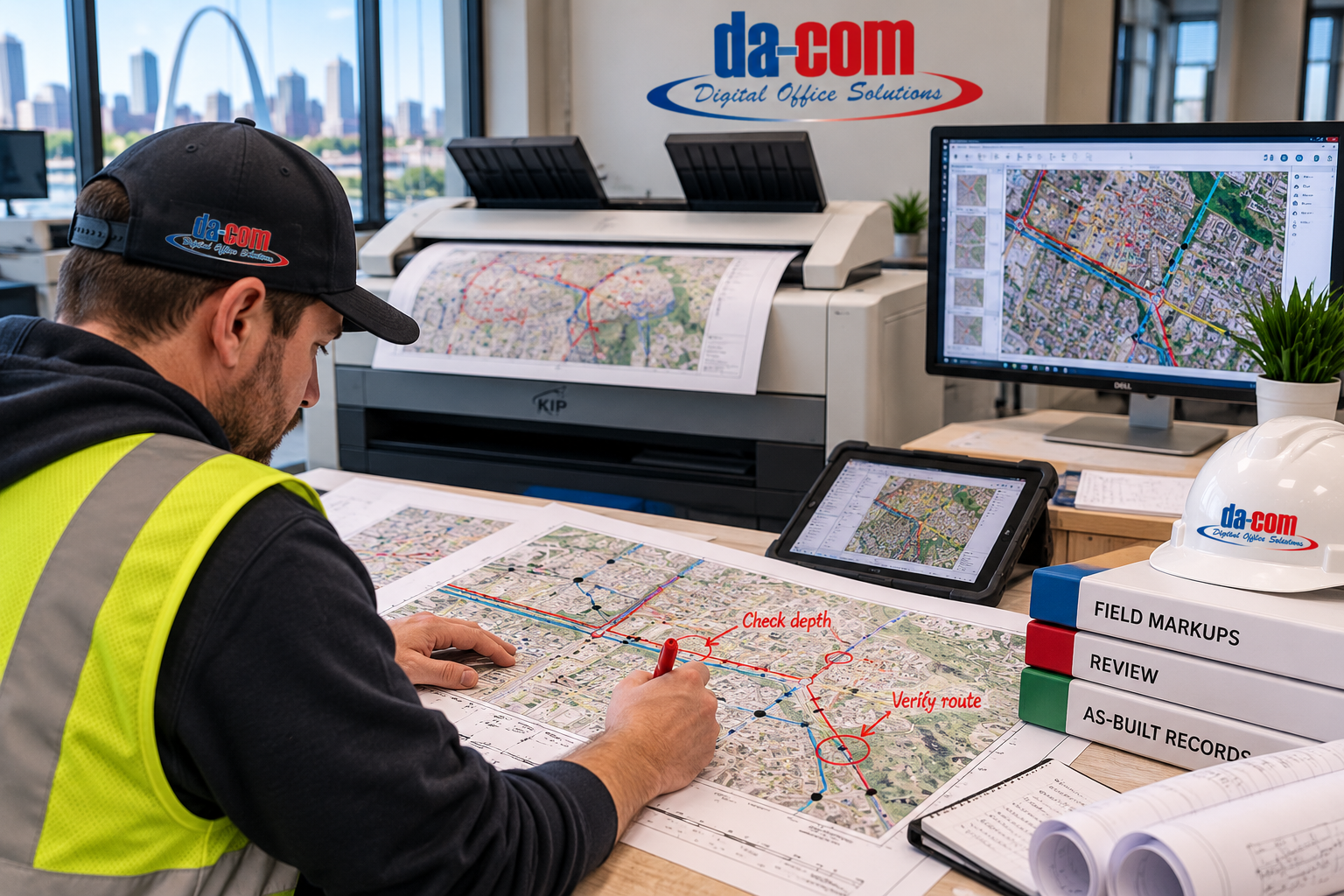
Telecom GIS Printing: Clear Maps and Better As-Built Records
Telecom GIS printing should help your team see the work clearly without creating another version of the project that nobody can track. Printed maps are still useful for field briefings, construction meetings, permit reviews, markups, and coordination, but they work best when each printed sheet stays connected to the source record, revision process, and review workflow.
This is not a choice between paper and digital tools. It is a handoff problem.
Picture a field supervisor marking a question on a route map. The note is useful. The location is circled. A photo has been taken. But when the sheet returns to the office, nobody can tell whether the mark is an observation, an approved change, or a reminder to ask engineering. The paper did its job in the field, but the handoff back to the project record failed.
That is why telecom GIS printing should be planned around what happens before and after the page is printed. A map should not only be readable. It should be clearly identified, easy to review, simple to scan, and connected to the right project record.
Da-Com helps telecom teams, fiber contractors, engineering offices, utility teams, and construction groups evaluate wide format printing and scanning solutions, including KIP wide format printers, large document scanning, folding, service, supplies, and document workflow support. For teams in St. Louis, St. Charles, Columbia, the Metro East, Belleville, Edwardsville, Collinsville, Southern Illinois, and nearby Midwest communities, Da-Com can help make printed GIS maps, field markups, and as-built records easier to manage.
Quick Answer: Why Do Telecom Crews Still Use Printed GIS Maps?
Telecom GIS printing gives crews, supervisors, engineers, and project managers a shared physical reference for field briefings, construction meetings, permit reviews, markups, emergency work, and coordination. Printed GIS maps work best as clearly identified views of controlled information. They should include source version, issue date, intended use, and revision status so users know what the map represents and where to find the current record.
Printed telecom maps can help teams:
- Review fiber route maps in group meetings.
- Brief field crews before dispatch.
- Discuss route questions across a conference table.
- Mark observations during field work.
- Compare construction drawings with mapped locations.
- Capture handwritten notes for review.
- Support as-built drawing review and documentation.
- Scan oversized markups back into a controlled workflow.
- Keep office and field teams aligned on what needs follow-up.
A printed sheet can make a conversation easier to follow. It cannot decide which information is correct, whether a proposed change is approved, or whether the GIS record should be updated. That responsibility still belongs to the project’s review process.
Know What Each Telecom GIS Document Represents
Before discussing print quality, start with document status. A proposed route, an issued construction drawing, a field markup, a reviewed change, and an as-built record may describe the same area, but they do not represent the same stage of work.
Make that distinction visible.
The U.S. Geological Survey describes GIS as a computer system that analyzes and displays information tied to geographic locations. USGS GIS explanation For telecom teams, GIS may help organize route information, asset locations, mapped features, boundaries, and other location-based project data.
When that information is printed, the sheet should explain what it represents. Your project’s rules should define how information is released, reviewed, updated, and accepted.
| Document or Record | What It Is Intended to Communicate | What Should Be Visible |
|---|---|---|
| Planning map | A proposed route or area under consideration. | Purpose, source, date, and review status. |
| Issued construction drawing | The instructions released for the identified work. | Sheet number, revision, and authorized use. |
| Field markup | An observation, question, or proposed correction. | Author, date, location, and action requested. |
| Reviewed change | A decision processed through the project’s controls. | Approval reference and affected documents. |
| As-built record | The completed-installation information accepted into the record. | Record status, review information, and relevant identifiers. |
| Printed reference copy | A paper view of a particular document issue. | Source version, issue information, and intended use. |
For telecom GIS printing, this status information is part of the usable output. Do not ask a crew to infer a document’s role from the color of a folder or from where the file happened to be stored.
The sheet should help the user understand what it is and where to go when something does not match the field situation.
Give Digital Tools and Paper Distinct Jobs
Digital tools and printed maps should not compete. Each format should have a defined job.
Digital GIS, project folders, document management systems, and controlled drawing repositories can help teams manage records, layers, approvals, comments, and updates. Printed maps can help people gather around the same reference, discuss a route, mark a location, or carry a focused field view to the jobsite.
For a coordination meeting, a large map can provide a common place to point, mark, and discuss. For a detailed review, a digital file may provide access to layers, supporting documents, approved comments, or the most current record.
The purpose should determine the format.
Avoid creating a parallel paper process where important information stays on a sheet and never reaches the project record. Also avoid treating every printed copy as a permanent record. Define which documents need to be retained and how that retention fits your organization’s requirements.
For example, a route review meeting may identify three questions on a printed map. The value of the session is not just the marks on the paper. It is the clear list of questions, the assigned reviewers, and the route for recording the answers.
Before the meeting ends, identify who owns the follow-up.
Telecom GIS printing should make the handoff easier to follow, not create a second place where unresolved work can disappear.
Make Telecom GIS Printing Readable Before It Becomes Routine
Review the actual printed map before turning it into a standard packet item. Start with the intended task.
Ask practical questions:
- Can a supervisor locate the assigned area quickly?
- Can the crew identify the referenced drawing?
- Can a reviewer understand the legend without asking the map’s author?
- Are labels readable at the intended output size?
- Do line styles remain distinguishable?
- Do neighboring sheets connect clearly?
- Are page edges and title blocks complete?
- Does the printed map show source and issue information?
For fiber route map printing, also inspect how neighboring sheets connect. A clear sheet is less useful when the reader cannot tell where the route continues.
Confirm output size and scale-related settings with the document owner where required. USGS identifies large-format plotting as one way to produce full-size map output in its map-printing guidance. USGS map printing guidance That guidance concerns USGS maps, so your telecom drawings still need their own project-specific checks.
Do not assume a readable map is an accurate field record simply because it printed well. Readability and source accuracy are separate questions.
For telecom field maps, keep the source and issue information on the page. Where useful, identify the controlled location from which a replacement should be obtained. Ask a person who did not prepare the map to review it. Their questions can show where the layout depends on knowledge that is not actually written down.
Use KIP Wide Format Printers for Repeatable Telecom Map Output
Da-Com focuses heavily on KIP wide format systems, which makes KIP a natural fit for telecom teams that regularly print GIS maps, fiber route maps, construction drawings, field packets, and returned markups.
Depending on the selected configuration, a KIP wide format workflow may include:
- Color and black-and-white wide format output.
- KIP print management tools.
- Accounting and cost center controls.
- Touchscreen operation.
- Fast media installation.
- Auto roll switching.
- Wide format scanning.
- Folding and stacking options.
- Consistent output for maps, drawings, and field documents.
These features matter because telecom GIS printing is rarely one isolated print job. A team may need to print a route map, review a construction drawing, scan a markup, route a question, update a controlled record, and produce a replacement sheet.
Da-Com’s Wide Format Printer Buyer’s Guide can help teams evaluate print volume, color needs, file complexity, roll handling, scanning, folding, service, supplies, and workflow before selecting equipment.
Ask for Field Markups Another Person Can Understand
A useful markup should not depend on the author being available to explain it later. Agree on a simple annotation standard before the project starts.
A field markup should identify:
- The project.
- The drawing or map being marked.
- The relevant location.
- The person making the note.
- The date.
- The reason for the note.
- Whether the note is an observation, question, or proposed correction.
- Any related photo or supporting document.
For example, “check route” is incomplete. A more useful note identifies the location, describes what needs review, and states what the author is asking the project team to resolve. The exact wording should follow your organization’s process.
Also establish how photographs connect to the markup. Use the same project and location references so the office does not have to guess which photo belongs to which note.
Avoid relying only on arrows when the intended point could be unclear. A short written explanation can give the reviewer necessary context.
For telecom GIS printing, the goal is not to turn field crews into document specialists. The goal is to give them a simple way to return information that someone else can act on.
Keep the process short enough to use during normal work. Then show an example during training. Ask the office reviewer whether the example contains enough information to decide the next step.
A neat scan cannot fix a note that never explained the issue.
Separate Capture, Review, and Record Updates
Do not collapse the return process into “scan and save.” Treat it as three separate steps.
| Step | What Happens | Why It Matters |
|---|---|---|
| Capture | The marked-up drawing is scanned and supporting photos or notes are collected. | Preserves the field information in a usable format. |
| Review | The responsible person determines what the information means and what action is needed. | Prevents a field note from becoming an assumed approval. |
| Record update | The appropriate controlled records are updated after required decisions are made. | Keeps as-built records, GIS data, and project files aligned. |
For wide format scanning telecom workflows, start by checking the capture itself. Confirm that the full page is present, the title block is readable, the page edges are complete, and the lightest annotations have not disappeared.
Then confirm file identity. Can the reviewer connect the scan to the correct project, drawing, and issue? Is it stored where the responsible person will find it? Is the original retained according to your process?
Da-Com offers wide format scanning support for oversized drawings, maps, blueprints, field markups, and archived paper records. Da-Com also provides Document Management solutions for teams that need help routing, organizing, storing, and retrieving files.
Those tools support a process. They do not make the engineering decision.
For as-built drawing printing, confirm which record has been accepted for the intended use before producing final copies. A marked-up drawing should not become an approved as-built simply because someone changed the filename.
Use Printed Maps Carefully During Urgent Work
Urgency is a reason to make document status clearer, not a reason to ignore it. For emergency repairs or other time-sensitive activity, the team should know which record it is using and where questions should be directed.
A printed reference can support the discussion, but it should not be treated as independent proof of current site conditions.
Keep the relevant project contacts and escalation process accessible. Identify who can confirm the appropriate records and who is authorized to make decisions about the work.
For excavation-related activities, follow applicable utility notification and field procedures. Missouri 811 states that excavators can request utility locates online or by phone at 811 and provides excavator resources for Missouri projects. Missouri 811 excavator resources For Illinois work, JULIE provides excavator resources and e-request information. JULIE excavator resources
A printed network map is not a substitute for those processes.
Also separate the operational record from public-facing communication. A resident, property owner, or stakeholder may need a clear explanation of the affected area without receiving the same detailed network information used by the technical team.
Telecom GIS printing should support each conversation with the appropriate view, not distribute the entire record to everyone involved.
Standardize the Repeated Parts of the Process
Make the common steps consistent while leaving room for project-specific requirements. Start with the title block and document identifiers. Agree on the minimum information that should appear on printed maps and returned markups.
Then standardize the request and return process:
- Who asks for a print?
- Who confirms the source?
- Who checks the output?
- Who receives field comments?
- Who scans returned markups?
- Who reviews the returned information?
- Who confirms that a correction has been reviewed?
- Who updates the controlled record?
Keep responsibilities visible.
For telecom field maps, define a normal packet order and a simple way to identify the assigned area. That helps supervisors find information without relearning the format on every job.
Do not confuse standardization with printing the same contents for everyone. The structure can stay consistent while selected drawings change.
Test the process with one project and ask both office and field teams where it creates extra work. Make the smallest useful adjustment, then test it again.
Da-Com’s Document Management Services provide another area to explore when the main problem is locating files, routing them for review, keeping versions organized, or improving search and retrieval.
Sometimes the immediate need is software. Sometimes the immediate need is a clear owner and a simpler naming rule. The goal is a process your team can repeat without rebuilding it from scratch.
Measure the Handoff, Not an Assumed Error Reduction
Do not promise that printed maps will reduce field errors by a specific percentage unless your own operation has measured it. Instead, track the document-handling problems your team actually experiences.
You might measure:
- How often a packet is missing a sheet.
- How often users ask which version is current.
- How often a returned markup needs clarification before review.
- How long it takes to assign a returned field note to the correct reviewer.
- How often scans are missing title blocks, edges, or light annotations.
- How often old packets remain in circulation after a revision.
- How often the office has to reprint a map because source information was unclear.
Use the same definitions before and after a process change. That gives your team a more useful basis for deciding whether the change helped.
For teams working across Missouri and Illinois, Da-Com’s Southern Illinois support information provides a starting point for discussing regional service needs. Confirm the arrangement for your equipment, location, and workflow.
Telecom GIS printing is most useful when the equipment, people, and document process are reviewed together.
Telecom GIS Printing Checklist
Use this checklist before making printed GIS maps part of a standard telecom field process.
- Define what each printed document represents.
- Include source, date, issue, and intended-use information on the sheet.
- Review the actual map at the intended output size.
- Check labels, line styles, symbols, legends, and neighboring sheet references.
- Confirm scale-related settings where required.
- Ask a person who did not prepare the map to review readability.
- Create a simple annotation standard for field markups.
- Connect photos and supporting notes to the same project and location references.
- Separate capture, review, and record updates.
- Use wide format scanning to preserve oversized field markups when needed.
- Confirm where scanned files go and who reviews them.
- Do not treat a scanned markup as an approved as-built record without review.
- Follow applicable utility notification and field procedures for excavation-related work.
- Track document-handling measures before and after process improvements.
Common Mistakes to Avoid
Treating Paper as a Replacement for Digital GIS
A printed map should be a view of controlled information. It should not become a disconnected version of the project record.
Printing Maps Without Status Information
Every printed map should make its source, purpose, issue, and intended use clear enough for the reader to understand what it represents.
Accepting Unclear Field Markups
A field note should identify the location, author, date, purpose, and requested action. A vague arrow or short phrase may not be enough for review.
Calling a Scan an As-Built Record Too Soon
Scanning captures information. It does not approve it. The responsible reviewer still needs to determine what belongs in the record.
Using Printed Maps as Locate Substitutes
Printed maps can support project understanding, but they do not replace required utility notification, locate, and field-verification procedures.
Measuring Success With Unsupported Claims
Track document-handling measures you can observe, such as missing sheets, version questions, unclear markups, and review handoff time.
Frequently Asked Questions About Telecom GIS Printing
Why use printed maps when our GIS is digital?
Printed maps are useful when a physical reference supports a specific activity, such as a field briefing, group review, coordination meeting, or markup session. The source record and update process should stay connected to the printed copy.
Does a scanned markup become an as-built record?
Not automatically. Scanning is capture. The information still needs the review, decisions, and record updates required by your project. Confirm which version has been accepted before using it as an as-built reference or producing final copies.
What should every field markup include?
A field markup should include enough information to identify the drawing, location, author, date, and purpose of the note. The reviewer should be able to tell whether it is a question, an observation, or a proposed correction.
Can a printed map be used to confirm buried utility locations?
No. Do not treat a printed map as a replacement for applicable locate and field-verification procedures. Use current official guidance and responsible project personnel. Printed maps can support understanding, but they do not authorize excavation or confirm site conditions.
How should we evaluate whether our telecom GIS printing process improved?
Choose a small set of document-handling measures and use them consistently. Track missing sheets, version questions, unclear returned markups, scanning problems, and review handoff time before and after a process change.
What is the role of wide format scanning in telecom GIS workflows?
Wide format scanning helps capture oversized maps, construction drawings, returned markups, and paper records so they can be reviewed, routed, stored, and connected to the correct project record.
Can Da-Com help with telecom GIS printing and scanning?
Yes. Da-Com helps telecom teams, fiber contractors, engineering offices, and project groups compare KIP wide format printers, oversized scanning, folding, service, supplies, document management, and workflow support in St. Louis, St. Charles, Columbia, the Metro East, Southern Illinois, and nearby communities.
What should we bring to a Da-Com workflow discussion?
Bring a current field map, a returned markup, a sample as-built record, and an example of a document handoff that creates confusion. Those materials can help identify where clearer printing, scanning, routing, or workflow support would help.
Keep the Paper Connected to the Project Record
Telecom GIS printing should give your team a clearer shared reference, not a disconnected stack of maps. Printed maps can support field briefings, construction meetings, permit reviews, markups, and coordination, but they work best when each sheet is clearly tied to the controlled source, revision process, and review responsibilities.
Start with one document and trace it through the full cycle: preparation, release, field use, markup, scan, review, and record update. That exercise can show where a clearer layout, a scanning step, better routing, or equipment support would help.
Da-Com helps telecom teams in St. Louis, St. Charles, Columbia, the Metro East, Belleville, Edwardsville, Collinsville, Southern Illinois, and nearby Midwest communities review wide format printing, KIP equipment, oversized scanning, document routing, service, supplies, and workflow support.
To review your telecom GIS printing and oversized-document workflow, contact Da-Com today. Bring a current field map and a returned markup. We can start with the handoff your team already uses and discuss a more repeatable way to keep the office and field connected.
Explore Da-Com’s Wide Format Printers, Wide Format Scanning Guide, Document Management, and Service and Supplies resources to build a clearer print, scan, and records workflow.


Leave A Comment