

Utility GIS Map Printing for Field Operations
Utility GIS map printing becomes important when information has to leave a computer screen and work in the real world. A GIS map may look perfect on a monitor, but field operations create different demands. The map may need to be opened in a truck, reviewed in a job trailer, marked up by a supervisor, shared during an outage, or placed on a table while several people talk through a problem.
That changes what “good” looks like.
For utility teams, a good map is not only accurate. It also needs to be readable, durable, current, and useful in the environment where the work is happening. The office team may need detailed layers. The field crew may need fast clarity. A contractor may need revision control. A public meeting may need a simplified route view. An emergency response team may need a large shared reference that everyone can see at once.
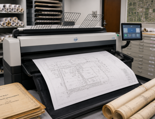
Da-Com helps utility teams turn complex digital information into large, readable maps and technical documents that people can actually use. Through wide format printing and scanning solutions, we support organizations that need reliable output for technical drawings, GIS maps, utility plans, infrastructure projects, field-ready documents, scanning, folding, supplies, and service.
Direct Answer: How Do Utilities Use GIS Map Printing?
Energy and utility companies use utility GIS map printing for outage planning, emergency response, underground utility mapping, infrastructure projects, construction plans, substation work, vegetation management, easements, public meetings, field markups, engineering reviews, and capital projects.
Printed maps are especially useful when:
- Several people need to see the same work area at once.
- Crews need to mark up information in the field.
- A supervisor needs a broad view of an outage, route, or service area.
- A project manager needs to explain phasing to a municipality or public group.
- Digital screens are too small for group review.
- Teams need a reference that works away from a desk.
- Field notes need to be scanned back into the project record.
The point is not to replace digital GIS tools. The point is to give utility teams the right format for the job in front of them.
Why Utility GIS Map Printing Still Matters
Utilities have more digital tools than ever. That is a good thing. GIS platforms, mobile apps, cloud files, asset databases, and tablets all help teams access information faster.
But a digital map and a printed map do not always solve the same problem.
A tablet is useful when one person needs to zoom into a valve, pole, meter, route, easement, or asset. A large printed map can be better when five people need to stand around a table and understand an entire work area. A digital layer can help an engineer analyze details. A printed field map can help a crew leader explain what needs to happen before the team leaves the yard.
That is why printed GIS maps remain useful in utility environments. HP identifies GIS and maps as a core application for large-format printers and plotters, which reflects how often technical teams still need physical output for complex spatial information. HP large-format printer applications
In utility work, the format matters because the setting matters. A map used in a conference room does not live the same life as a map used in a service truck, command center, field trailer, or public meeting.
GIS Maps for Daily Utility Operations
GIS systems can contain a huge amount of information. For utility teams, that information may include assets, routes, boundaries, service areas, easements, equipment, infrastructure conditions, and project details.
Different utilities may rely on different map layers:
- Water departments may map valves, hydrants, mains, service lines, pressure zones, treatment assets, and planned improvements.
- Wastewater teams may map manholes, sewer lines, lift stations, laterals, treatment facilities, and inspection areas.
- Electric utilities may map poles, circuits, substations, transmission routes, service territories, transformer locations, and outage areas.
- Gas utilities may use maps for mains, service areas, construction projects, field planning, and maintenance work.
- Telecommunications and broadband teams may use GIS maps for fiber routes, splice points, permits, make-ready work, and construction planning.
Large format printing for utilities can help convert those layers into practical field documents that support real work. Printed versions can help with:
- Crew briefings.
- Maintenance planning.
- Capital projects.
- Contractor meetings.
- Field markups.
- Emergency response.
- Public meetings.
- Engineering reviews.
- Route planning.
- Asset replacement planning.
- Vegetation management.
- Inspection planning.
When the map is going into the field, the output conversation should include more than size. It should include how the map will be handled, how long it needs to last, who needs to mark it up, and how often it will be replaced.
Outage Map Printing and Emergency Response
Normal utility work is one thing. Storm response is another.
When weather moves through Missouri or Southern Illinois, priorities can change quickly. Teams may need maps for command centers, restoration planning, crew staging, road access, service territories, damage assessment, public communication, and coordination with contractors or municipal partners.
Outage map printing can give a room of people a shared view during fast-moving events. One person can point to an area. Another can mark a change. A supervisor can see the larger picture without passing around a tablet or crowding around one screen.
Large printed maps may support:
- Storm response planning.
- Crew staging and dispatch.
- Restoration tracking.
- Road closure awareness.
- Service territory review.
- Critical facility identification.
- Damage assessment.
- Command center coordination.
- Public information planning.
The same idea applies to water main breaks, sewer emergencies, gas incidents, flooding, power interruptions, and other events that require quick coordination.
A printed map becomes a working tool. That is why wide format printing should be part of emergency readiness, not just routine office printing.
Large Format Printing for Infrastructure Projects
Infrastructure projects create documents from the first planning meeting to the final as-built. A utility project may begin with route studies, move into engineering, advance through permitting and construction, and end with updated records that need to be preserved for future maintenance.
Infrastructure project printing may include:
- Route maps.
- Site plans.
- Engineering drawings.
- Easement maps.
- Construction phasing maps.
- Bid drawings.
- Permit sets.
- Redlines.
- As-builts.
- Public meeting boards.
- Traffic control reference materials.
- Utility coordination maps.
Every group may need something slightly different. Engineering wants detail. Field crews want clarity. Municipal leaders may want an overview. Residents want to know what is happening near their homes.
A good large-format workflow helps the same project information serve different audiences without creating confusion.
Da-Com’s guide on weather-resistant construction plans explains why some field documents need more durability when plans are exposed to moisture, dirt, repeated handling, vehicles, and outdoor site conditions.
Make Complex Utility Work Easier to Understand
Utility work can be complex. That is especially true when the public is involved.
A utility project may make perfect sense to the engineers who have worked on it for two years. A resident may only see orange barrels, flags, equipment, or crews near a street and want to know three things:
- What is happening?
- How long will it take?
- How will it affect me?
Large route maps, phasing boards, neighborhood project signs, easement visuals, and public meeting displays can help answer those questions. They can also help project leaders explain why a project is happening, which areas are affected, what sequence the work will follow, and where people can expect temporary disruption.
FHWA work-zone resources emphasize the role of communication strategies, planning, and public information in helping people understand work-zone impacts. Utility and infrastructure teams can apply that same practical idea when they use maps, boards, and field-ready visual materials to explain what is changing and why. FHWA work zone public information and outreach strategies
When people can see the work area clearly, project teams have a better chance of reducing avoidable confusion.
Printed Maps Help Connect Office and Field Teams
Utility project managers often sit between several groups. Engineering changes a drawing. The field needs the new version. A contractor needs another set. A municipality asks a question. A supervisor makes a field note. A crew returns with a marked-up map.
That information has to keep moving.
Printed maps and plans can become part of that bridge between office and field teams. They help translate technical digital information into something crews can use in the moment.
But there is a catch.
Version control matters.
An old map in a truck can create the same kind of problem as an old drawing in a plan set. If the field crew is working from outdated information, the fact that the map is printed clearly does not help much.
That is why utility teams should have a clear process for:
- Dates.
- Revisions.
- Distribution.
- Replacement copies.
- Marked-up returns.
- Scanning and digital filing.
- Archive copies.
- Emergency sets.
The goal is simple: make it easy for people to know they are looking at the right information.
Field Maps Need to Be Built for the Field
A standard paper map may be fine for a meeting room. It may not be fine for a muddy jobsite, service truck, command center, or outdoor utility project.
Field maps can be exposed to rain, dirt, wind, sunlight, folding, rolling, and repeated handling. Depending on the job, teams may want:
- Lamination.
- Water-resistant or weather-resistant media.
- Heavier material.
- Folded map sets.
- Multiple field copies.
- Dry-erase surfaces.
- Mounted boards for command centers.
- Truck sets.
- Job trailer sets.
The best answer depends on where the map is going. If it will be used once in an office, simple paper may be right. If it will live in a field truck for weeks, the answer may change.
That is what “built for the field” means. It means the map is designed for the environment where people will actually use it.
GIS Print Quality Is About More Than Color
GIS maps can be dense. A utility map may include several colors, fine boundaries, labels, symbols, asset IDs, service areas, underground routes, parcels, roads, easements, environmental features, and overlapping layers.
The printer needs to keep that information readable.
For engineering map printing, quality is not just about whether the output looks colorful. It is about whether the people using the map can understand the information quickly and accurately.
When evaluating equipment or print output, utility teams should review:
- Small text readability.
- Fine line separation.
- Color differentiation.
- Layer clarity.
- Symbol visibility.
- Print speed.
- Media compatibility.
- Repeatability across revisions.
HP notes that technical plotters support professional applications such as architecture, engineering, construction, GIS, maps, technical drawings, and plans. For utility teams, that reinforces why real-world file testing matters before choosing a workflow or printer. HP DesignJet technical plotters
Do not judge a system only by a manufacturer’s sample. Give it a real GIS map. Give it a drawing your team prints every week. Look at the small text. Look at line separation. Look at color. Look at how long the job takes.
That tells you much more than a glossy demonstration page.
Scanning Completes the Field Loop
A printed map often comes back with new information. A crew may add notes. An engineer may mark a change. A contractor may return a redline. A supervisor may sketch an access issue. A field team may identify a condition that needs to be updated in the record.
That is where scanning becomes valuable.
A wide format scanner can help capture that field information so it can move back into the digital project record. Instead of treating printing and scanning as two separate jobs, utility teams can look at them as one workflow:
- Office to field.
- Field markup.
- Scan back to office.
- Update the record.
- Issue the next revision.
Da-Com offers wide format scanning support for businesses that need to digitize blueprints, scan construction plans, archive engineering drawings, preserve large documents, and improve scan-to-file workflows.
For organizations with older utility plans, scanning can also help preserve legacy documents. Many utilities still rely on older drawings, paper maps, historical infrastructure records, or archived plan sets. Digitizing those documents can make them easier to find, share, protect, and use alongside newer digital workflows.
What Utility Teams Should Ask Before Buying Wide Format Equipment
The right equipment should fit the workflow. The workflow should not be forced to fit the equipment.
Before investing in a printer, scanner, or full wide format workflow, utility teams should ask practical questions about how maps and plans are actually used.
| Workflow Question | What It Tells Us |
|---|---|
| How large are your GIS maps? | Required printer width and media size. |
| Are maps mostly color or black and white? | Printer, ink, toner, and operating cost needs. |
| How detailed are the layers? | Required technical print quality and readability. |
| How many people print? | Workflow, queue, permissions, and print management needs. |
| Are maps used outside? | Media, finishing, lamination, and durability needs. |
| Do crews mark up prints? | Scanning, redline capture, and revision workflows may be important. |
| Do you print during emergencies? | Speed, reliability, supplies, and service support matter. |
| Are files sensitive? | Security, access controls, and print management need review. |
| Do you maintain legacy drawings? | Wide format scanning and archival workflows may be needed. |
These questions help utility teams avoid buying based only on device specifications. A faster printer is not enough if the output is hard to read. A color device is not enough if field maps cannot survive the jobsite. A scanner is not enough if no one knows where the files should go after scanning.
The better question is: what workflow does your utility team need to support?
Local Support Matters When the Work Is Local
St. Louis, Columbia, the Metro East, and Southern Illinois utility work covers a large footprint. Projects may move from engineering offices to municipalities, plants, substations, service centers, contractors, public works teams, and jobsites.
That makes local support important.
When a utility team depends on wide format printing during a construction phase, outage event, public meeting, or emergency response, delays create problems. A print workflow should make the job easier, not create another issue for project managers or field supervisors to manage.
Da-Com supports customers with wide format equipment, supplies, scanning, service, and workflow guidance. Whether your team is evaluating new equipment, improving a print process, digitizing old maps, or trying to reduce field document confusion, a local partner can help connect the right technology to the way your team actually works.
Utility GIS Map Printing Checklist
Use this checklist before building or upgrading your wide format workflow.
- Identify the maps your team prints most often.
- Review common map sizes and required printer widths.
- Test output with real GIS files, not only sample files.
- Check small labels, line clarity, symbols, and dense layers.
- Determine whether field maps need lamination or durable media.
- Review how crews mark up maps in the field.
- Decide whether wide format scanning is needed.
- Create a revision and replacement process.
- Review who can print sensitive maps or infrastructure files.
- Plan for emergency response printing needs.
- Evaluate supplies, media, toner, ink, and service availability.
- Choose a local support partner that understands technical documents.
Frequently Asked Questions About Utility GIS Map Printing
What size printer is best for GIS maps?
The best printer size depends on the normal map size your team uses. 24-inch, 36-inch, and 44-inch equipment can all support GIS work. Many utility and engineering teams find 36-inch output practical for technical printing, while larger overview maps may call for 44-inch equipment.
Can GIS maps be laminated?
Yes. Lamination can make frequently handled field maps easier to protect from moisture, wear, folding, and repeated use. Lamination may be especially helpful for maps used in trucks, trailers, command centers, or outdoor field work.
Do printed maps still make sense if our crews have tablets?
Yes. Tablets and printed maps can work together. Tablets are helpful for individual access and zooming into details. Large printed maps are useful for group review, markups, planning meetings, outage response, command centers, and broad-area visibility.
Can old utility maps be scanned?
Yes. Wide format scanners can digitize many older drawings and maps, helping utilities preserve legacy information and make large documents easier to organize, share, and archive.
What is the difference between GIS map printing and poster printing?
GIS map printing is focused on accurate, readable technical information. GIS maps often contain fine details, small labels, linework, symbols, boundaries, and overlapping layers. The goal is not simply to produce a large colorful image. The goal is to make complex spatial information usable.
What should utilities look for in a wide format printer?
Utility teams should look at print width, color needs, technical line quality, small text readability, speed, media compatibility, security, print management, scanning options, supplies, and local service support.
Does Da-Com support utility teams in Southern Illinois?
Yes. Da-Com supports organizations across St. Louis, Columbia, the Metro East, and Southern Illinois with wide format printers, scanners, supplies, service, and workflow guidance for technical documents and field-ready plans.
Keep Office and Field Teams on the Same Page
A utility map is not just something to hang on a wall. It can help a crew understand a work area. It can help a command center see a problem. It can help an engineer explain a change. It can help residents understand why work is happening in their neighborhood.
Utility GIS map printing helps utility teams turn complex digital information into practical field tools. The right workflow can support daily operations, emergency response, infrastructure projects, public meetings, field markups, scanning, version control, and long-term records.
Da-Com helps utility teams choose wide format printers, scanners, media, supplies, and service that support those real jobs.
For utility GIS map printing equipment and wide format support in St. Louis, Columbia, the Metro East, Belleville, Edwardsville, Collinsville, or Southern Illinois, contact Da-Com today. We will help you build a workflow that keeps the right information moving from the office to the field.




Leave A Comment