

Telecom GIS Printing: Reduce Field Errors
Telecom GIS printing helps field crews, engineers, construction managers, utility coordinators, and broadband deployment teams reduce errors by turning complex digital map data into clear, large-format documents that can be reviewed, marked up, shared, and used in the field.
Digital GIS tools are essential in telecommunications. They help teams manage location data, service areas, fiber routes, tower locations, utility corridors, customer density, coverage gaps, and network planning. But even with strong digital tools, printed GIS maps and as-built drawings still play an important role in field accuracy.
When crews are preparing for construction, repairs, inspections, permit reviews, or network updates, a small screen is not always enough. Field teams often need to see the full route, compare nearby infrastructure, mark real-world changes, coordinate with contractors, and confirm that the plan matches what they see on site.
That is where telecom GIS printing becomes valuable. Printed GIS maps, fiber route maps, telecom field maps, redline markups, and as-built drawings give teams a shared reference that is easy to review during meetings, carry into the field, and use for documentation after work is complete.
For telecom companies, fiber contractors, engineering firms, utilities, broadband deployment teams, and construction partners in St. Louis, St. Charles, Columbia, the Metro East, Belleville, Edwardsville, Collinsville, and Southern Illinois, clear printed maps can help reduce confusion, rework, missed details, and field delays.
Quick Answer: Why Do Telecom Crews Still Need Printed GIS Maps?
Telecom GIS printing gives crews large, readable printed maps that help them review fiber routes, utility conflicts, construction zones, right-of-way areas, tower sites, service boundaries, redline markups, and as-built changes. Digital GIS tools are important, but printed GIS maps are still useful for field crews, construction meetings, permit reviews, emergency repairs, stakeholder coordination, and documenting what was actually built.
Printed GIS maps and as-built drawings help telecom teams:
- See full fiber routes at a readable scale.
- Review complex GIS layers with multiple stakeholders.
- Mark up field changes quickly.
- Compare planned routes with real site conditions.
- Coordinate with contractors, inspectors, and municipalities.
- Reduce confusion between engineering and field teams.
- Support emergency repair work.
- Capture accurate as-built documentation after deployment.
- Give crews a reliable reference when tablets, phones, or connectivity are limited.
Da-Com provides wide format printer solutions for teams that need large-format printing, scanning, folding, print management, and support for maps, construction drawings, technical documents, and field-ready plans.
Why Telecom GIS Printing Still Matters in a Digital Workflow
Telecom work is increasingly digital, but the field is still physical. Fiber does not run through a spreadsheet. Towers are not built inside a GIS platform. Utility conflicts, road crossings, easements, construction access, and field conditions happen in real locations with real constraints.
Digital GIS systems help teams plan and manage those locations. Printed maps help people communicate about them.
The U.S. Geological Survey describes GIS as a system that analyzes and displays geographically referenced information. In telecom, that geographic information can include routes, service areas, towers, parcels, roads, utility corridors, customer locations, and network assets. USGS GIS resource
Telecom GIS printing matters because printed large-format documents can make location-based data easier to review in collaborative settings. A printed map gives everyone in the room or at the jobsite the same reference. Engineers, project managers, contractors, municipal reviewers, and field supervisors can point to the same route, circle the same conflict, and mark the same change.
That shared view can reduce misunderstandings that happen when everyone is looking at a different screen, zoom level, map layer, or file version.
Telecom GIS Printing and Field Error Reduction
Field errors often happen when the documentation does not match the work. A crew may be using an outdated route map. A utility conflict may not be clear. A right-of-way boundary may be missed. A field change may be marked verbally but never captured in the project record. A printed map may be too small to show important details. A digital map may be difficult to read in bright sun or low connectivity.
Telecom GIS printing can help reduce these issues by making field documentation more visible, readable, and easier to discuss.
Printed GIS maps can help reduce field errors by supporting:
- Clear route review before crews deploy.
- Better identification of utility conflicts.
- More accurate construction meeting discussions.
- Faster markup of unexpected field conditions.
- Improved communication between office and field teams.
- Better handoff between contractors and engineering teams.
- More reliable as-built updates after work is complete.
- Reduced reliance on memory, screenshots, or informal notes.
The goal is not to replace digital GIS tools. The goal is to use printed GIS maps as a practical field communication tool when map detail, group coordination, and markups matter.
Printed GIS Maps vs. Digital GIS Tools
Telecom teams do not need to choose between digital GIS and printed maps. They need both. Digital tools help teams store, update, analyze, and manage data. Printed maps help teams review, share, mark, and coordinate that information in the field.
| Category | Digital GIS Tools | Printed GIS Maps |
|---|---|---|
| Best use | Data management, analysis, updates, layers, and records | Field review, meetings, markups, crew packets, and stakeholder coordination |
| Viewing detail | Zoomable, but limited by screen size | Large-format view of routes, layers, and construction areas |
| Field reliability | May depend on battery, screen visibility, device access, or connectivity | Works without power, signal, login, or device sharing |
| Collaboration | Useful for remote teams and data updates | Strong for group review around one shared map |
| Markups | Can be digital if tools and workflows are in place | Easy for redlines, notes, circles, and field comments |
| As-built process | Stores final data and records | Captures field changes that can be scanned back into the record |
For telecom teams, the strongest workflow often includes digital GIS for data management and telecom GIS printing for field communication, review, and as-built documentation.
Fiber Route Map Printing for Field Crews
Fiber route map printing is one of the most important uses of telecom GIS printing. Fiber routes often span large areas, cross public rights-of-way, follow roads or utility corridors, connect neighborhoods, pass through commercial zones, and involve multiple installation phases.
Printed fiber route maps can show:
- Backbone routes.
- Distribution routes.
- Last-mile build areas.
- Underground fiber paths.
- Aerial fiber paths.
- Conduit routes.
- Handholes.
- Cabinets.
- Splice locations.
- Pole lines.
- Road crossings.
- Utility conflicts.
- Construction phases.
- Service boundaries.
These details are difficult to review on small prints. When a map is printed at a large size, crews can see the full route and still read the details that matter. That can help reduce mistakes before the crew reaches the jobsite.
The FCC’s National Broadband Map displays where internet services are available across the United States based on data reported by internet service providers. Broadband planning teams may use map-based availability data as one input when evaluating service gaps and deployment needs. FCC National Broadband Map information
As-Built Drawing Printing and Scanning
As-built drawings are critical because they show what was actually installed, not only what was planned. In telecom construction, field conditions often create changes. A route may shift because of a utility conflict. A handhole may move. A cabinet placement may change. A field crew may uncover conditions that were not visible during planning.
As-built drawing printing and scanning help teams capture those changes.
A strong as-built workflow may look like this:
- Engineering prints the approved field plan.
- The crew uses the printed plan during deployment.
- Field changes are marked directly on the drawing.
- The marked-up drawing is returned to the office.
- The drawing is scanned with a wide format scanner.
- Engineering updates the digital record.
- The final as-built drawing is stored for future maintenance and expansion.
This process helps reduce the gap between planned infrastructure and actual infrastructure. That gap matters because future crews may rely on as-builts for repairs, upgrades, troubleshooting, expansion, and emergency response.
Da-Com’s Wide Format page includes wide format scanning solutions designed for high-resolution image quality and production-speed scanning, which can help teams capture redlines, archived drawings, and large technical documents. Explore Da-Com Wide Format scanning solutions
Telecom Field Maps for Construction Meetings
Construction meetings often involve multiple stakeholders. A telecom project may include engineering teams, construction managers, fiber contractors, utility partners, municipalities, inspectors, subcontractors, and field supervisors.
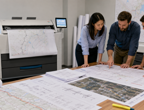
Telecom field maps make these meetings more productive because they give everyone a shared visual reference. Instead of describing a route verbally or passing around a laptop, the team can gather around a large printed map and review the work together.
Printed telecom field maps can support discussion around:
- Route changes.
- Right-of-way access.
- Permit boundaries.
- Utility coordination.
- Construction sequencing.
- Traffic control references.
- Work zone constraints.
- Customer impact.
- Inspection requirements.
- Field crew assignments.
When the team can see the same plan, it becomes easier to catch problems before they reach the field.
Telecom GIS Printing for Permit Reviews
Permit review is another area where printed GIS maps and large-format drawings can reduce confusion. Broadband deployment may require local approvals, right-of-way permits, easements, municipal authorizations, and other documentation depending on the project and location.
NTIA notes that broadband permitting can involve approvals, authorizations, easements, and right-of-way permits from towns, counties, and other municipal entities. NTIA broadband permitting resources
Printed large-format documents can help during permit review because they make route details and construction areas easier to evaluate. A permit package may include:
- Fiber route maps.
- Right-of-way drawings.
- Site plans.
- Construction drawings.
- Utility coordination notes.
- Traffic control references.
- Environmental or access considerations.
- Municipal boundary references.
Telecom GIS printing helps teams prepare permit materials that are easier to read, review, and mark up when questions arise.
Emergency Repairs and Outage Response
Printed GIS maps can also support emergency repairs and outage response. During an outage, teams may need to locate routes, identify nearby assets, understand splice points, review service areas, and coordinate repairs quickly.
Digital systems are essential during emergency response, but printed maps can help crews and supervisors review the affected area without relying only on device screens. A printed map can be posted, marked, shared, and referenced by multiple people at the same time.
Printed telecom maps may help outage response teams:
- Identify affected route segments.
- Locate cabinets, handholes, or splice points.
- Review alternate routes.
- Coordinate multiple repair crews.
- Mark suspected damage locations.
- Plan access routes.
- Document temporary fixes.
- Update as-built records after repairs.
When time matters, a clear printed map can help the team coordinate more quickly.
Wide Format Scanning for Telecom Redlines
Wide format scanning is the bridge between field markups and digital records. If crews write notes on printed maps but those notes are never scanned or updated, the organization loses valuable information.
Wide format scanning can help telecom teams:
- Capture redline markups.
- Preserve as-built changes.
- Archive old maps and drawings.
- Share field updates with engineering.
- Reduce paper storage.
- Improve records for maintenance and expansion.
- Support closeout documentation.
Da-Com’s article on wide format printers for project teams explains how large-format output supports maps, technical drawings, field use, collaboration, and project communication.
For telecom teams, scanning should be part of the map workflow from the beginning. The process should not stop when the plan is printed. It should continue through field markup, scan-back, revision, and final recordkeeping.
How Printed GIS Maps Support Stakeholder Coordination
Telecom projects often involve people who do not work in the same system every day. A contractor may not have access to the internal GIS platform. A municipal reviewer may need a printed permit set. A utility representative may want a route map for coordination. A field crew may prefer a printed packet. A leadership team may need a clear map for project review.
Printed GIS maps make it easier to share complex information with a wider group of stakeholders.
Stakeholders who may benefit from printed telecom maps include:
- Project managers.
- Network engineers.
- Construction supervisors.
- Fiber crews.
- Utility coordinators.
- Municipal reviewers.
- Inspectors.
- Subcontractors.
- Emergency repair teams.
- Leadership teams.
- Customer-facing project representatives.
When multiple groups need to understand the same project, printed maps can reduce the translation problem between technical data and field action.
Best Practices for Telecom GIS Printing
To get the most value from telecom GIS printing, teams should treat printed maps as part of the project workflow, not a last-minute output.
Use the Right Print Size
Do not shrink complex GIS maps or fiber routes until they become unreadable. Print at a size that preserves labels, routes, symbols, and layer detail.
Keep Revision Dates Visible
Every printed map should make it clear which version crews are using. Revision dates, job numbers, and project names help prevent confusion.
Use Color When Color Carries Meaning
If GIS layers depend on color, print in color. Routes, utilities, work phases, boundaries, and service areas may be harder to understand in black and white.
Plan for Redlines
Give crews room to mark changes. Redline notes should be expected, captured, scanned, and returned to the digital record.
Remove Old Versions
Outdated maps create risk. Teams should have a process for replacing old field packets when revised prints are issued.
Scan As-Builts Promptly
Marked-up drawings should be scanned while the field information is still current and easy to clarify.
Telecom GIS Printing Checklist
Use this checklist before sending printed maps or drawings to the field.
- Current fiber route map printed at readable scale.
- GIS layers checked for clarity.
- Color used where layers need visual separation.
- Construction drawings included when needed.
- Right-of-way details included.
- Utility markups printed and reviewed.
- Permit drawings matched to the latest revision.
- Field crew maps prepared by work area.
- Revision date visible on each document.
- Old versions removed from circulation.
- Redline space available for field notes.
- As-built scan-back process defined.
- Project number or job name clearly identified.
- Crews know where to return marked-up drawings.
Common Mistakes That Lead to Field Errors
Using Maps That Are Too Small
Small maps can hide important details. Complex fiber routes, utility conflicts, and GIS layers should be printed at a size that supports field review.
Sending Outdated Plans to the Field
Old versions can create rework and confusion. Telecom GIS printing should include a clear revision-control process.
Skipping the Redline Process
If field changes are not marked and scanned, the project record may become inaccurate.
Relying Only on Screens During Group Reviews
Digital tools are useful, but a large printed map can make group coordination easier during meetings and field briefings.
Not Scanning As-Builts Quickly
As-built updates are most useful when they are captured promptly and returned to the digital record.
How Da-Com Supports Telecom GIS Printing
Da-Com helps project teams evaluate wide format printing and scanning workflows for telecom maps, construction drawings, field documents, redlines, and as-builts. For telecom teams, the right wide format setup should support not only print output, but also map clarity, scanning, revision control, field packet preparation, and service reliability.
Da-Com can help with:
- KIP wide format printer options.
- Color and black-and-white technical output.
- GIS map printing workflows.
- Fiber route map printing.
- Wide format scanning for redlines and as-builts.
- Folding options for plan sets and field packets.
- Supplies and media planning.
- Print management and cost tracking.
- Service and support.
- Buy, lease, or outsource comparisons.
Da-Com’s guide to in-house wide format printing explains how bringing large-format output in-house can help teams reduce waiting time, respond faster to changes, and produce materials when project deadlines demand it.
Frequently Asked Questions About Telecom GIS Printing
What is telecom GIS printing?
Telecom GIS printing is the process of printing large-format GIS maps, fiber route maps, network plans, utility markups, field maps, and as-built drawings for telecom planning, deployment, construction, repairs, and documentation.
Why do telecom crews still need printed maps?
Telecom crews still need printed maps because large-format documents are easy to review, mark up, share, and use during field work, construction meetings, permit reviews, emergency repairs, and stakeholder coordination.
How does telecom GIS printing reduce field errors?
Telecom GIS printing helps reduce field errors by giving crews current, readable maps that show routes, utilities, right-of-way details, construction notes, and field changes at a scale that supports accurate review.
What are as-built drawings in telecom?
As-built drawings show what was actually installed in the field. They may include route changes, equipment locations, utility conflicts, redline notes, and updates that differ from the original plan.
Why is wide format scanning important for telecom teams?
Wide format scanning helps telecom teams digitize redlines, field markups, archived maps, and as-built drawings so updates can be shared, stored, and used for future maintenance or expansion.
Are printed GIS maps still useful if teams use tablets?
Yes. Tablets are useful, but printed GIS maps provide a large shared reference that works without battery, signal, login access, glare concerns, or small-screen limitations.
What telecom documents should be printed in large format?
Telecom teams may print GIS maps, fiber route maps, construction drawings, right-of-way plans, permit sets, utility markups, field crew maps, redlines, tower plans, and as-built drawings.
Does Da-Com support telecom GIS printing?
Yes. Da-Com supports wide format printing, scanning, folding, supplies, equipment planning, and service for telecom teams, fiber contractors, engineering firms, and project groups in St. Louis, Columbia, Missouri, the Metro East, and Southern Illinois.
The Bottom Line: Printed Maps Help Crews Work More Accurately
Telecom GIS printing helps reduce field errors by giving teams clear, large-format documents they can review, mark up, share, and use throughout the project lifecycle. Digital GIS tools are essential, but printed GIS maps and as-built drawings still provide practical value during planning, field deployment, construction meetings, permit reviews, emergency repairs, and stakeholder coordination.
Fiber routes, utility conflicts, right-of-way limits, construction drawings, redlines, and as-built changes are too important to leave unclear. A strong print and scan workflow helps teams keep the office, field, and project record aligned.
To learn more about telecom GIS printing, as-built drawing printing, fiber route map printing, telecom field maps, wide format scanning, and KIP wide format solutions for your St. Louis, St. Charles, Columbia, Metro East, Belleville, Edwardsville, Collinsville, or Southern Illinois project team, contact Da-Com today. Da-Com can help your team evaluate wide format printers, scanning systems, folding options, supplies, service, and field documentation workflows that help reduce errors and keep telecom projects moving.



Leave A Comment